
The Caldera de Taburiente
 The Caldera de Taburiente from the Roque de los Muchachos
The heart of La Palma is the Caldera de Taburiente.
Caldera is a technical geological term for the crater at the top of a volcano. In fact the term comes from La Palma: all the volcanic calderas in the world were named after ours. So it's really a pity that, since then, the scientists have found out that the Caldera de Taburiete isn't a caldera. It was actually formed by erosion and a gigantic landslide.
However it was formed, the Caldera is spectacular. In most places it's eight kilometres (five miles) across, and many of the rim walls are 1,500 metres high and almost sheer. I haven't seen the Grand Canyon yet, but people who've seen both frequently say that the Caldera looks bigger. You see the Caldera is just on the edge of what your brain can understand, whereas it just gives up when faced with the Grand Canyon.
The Caldera is surprisingly hard to photograph well, because you loose the sense of scale. This photo was taken from the observatory late one morning, and the scale mostly comes from the aerial perspective - the way distant objects are bluer. On this day there was just the right amount of dust in the air to give a sense of scale without hiding more distant details. I like the way the sunlight catches the cloud waterfall.
It's even more beautiful from inside, although that does mean a long hike. You can stay at the Caldera campsite for a couple of nights to give you more time to explore.
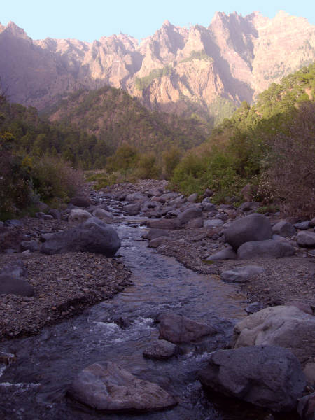 The Taburiente, near the Caldera camp site
Labels: Caldera de Taburiente, camp sites, hiking, scenery, walking
Bookmark with:
 Del.icio.us Del.icio.us
|
 Digg Digg
|
 Reddit Reddit
|
 Facebook Facebook
|
 Furl It Furl It
|
 Newsvine Newsvine
|
|
posted by Sheila, Canary Islands @ 11:50
![]()
![]()


0 Comments:
Post a Comment
Subscribe to Post Comments [Atom]
<< Home