A small rock in the Atlantic

All about the island of La Palma, in the Canaries.

Click for La Palma, Canary Islands Forecast

Tuesday, 23 August 2011

Terrific time-lapse video of La Palma

Enjoy Christoph Malin's wonderful time-lapse video of La Palma. He very nearly does the place justice.

Labels: ,

Bookmark with:

Del.icio.us Digg Reddit Facebook Furl It Newsvine StumbleUpon ToolbarStumbleUpon

Tuesday, 16 August 2011

La Cancelita Viewpoint

La Cancelita Viewpoint, Los Llanos, La Palma, Canary Islands
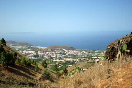
The view of Los Llanos from La Cancelita

La Palma has even more glorious viewpoints then the other Canary Islands. One of my favourites is La Cancelita, where you get two amazing views for the price of one. The good view covers Los Llanos and a good chunk of the surrounding plain. (Los Llanos means 'the plains' but it's not that flat by UK standards.
La Cancelita Viewpoint, Los Llanos, La Palma, Canary Islands
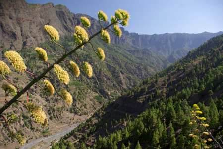
The view of the Caldera de Taburiente from La Cancelita

And the fantastic view sweeps down across the Caldera de Taburiente. All right, so you get fantastic views of the Caldera from almost anywhere around its rim, and from an awful lot of the Caldera floor, too. But this ones very accessible -- just a short drive from Los Llanos.
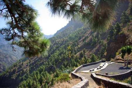
Follow the brown signs for the Caldera, and then take Calle Cancelita. You'll need to park when you run out of tarmac, and then walk along the dirt track for about five minutes. Believe me, it's worth it.

La Cancelita Viewpoint, Los Llanos, La Palma, Canary Islands
La Cancelita viewpoint

Labels: , , ,

Bookmark with:

Del.icio.us Digg Reddit Facebook Furl It Newsvine StumbleUpon ToolbarStumbleUpon

Tuesday, 10 May 2011

Robert's Wall (la pared de Roberto)


This photo was taken from the viewpoint at Los Andennes, where you get a spectacular view into the Caldera.

From here you can see a dyke called La Pared de Roberto (Robert's Wall). It's about four metres high (13ft).

[Volcanic dykes are formed when moulten lava fills a crack in the rock and solidifies slowly into very hard rock called basalt. Later on the softer, surrounding rock is eroded away, leaving the harder basalt sticking out like a wall.]

The story is that Roberto was madly in love with a girl who lived the other side of the wall, and he couldn't get through. Eventually the devil appeared to him and promised to carry Roberto's body through in exchange for Roberto's soul.

Roberto was daft enough to agree.

With a great flash of light, the devil blasted a hole through the dyke and left Roberto's dead body on the far side. He'd already taken the soul.

Labels: , ,

Bookmark with:

Del.icio.us Digg Reddit Facebook Furl It Newsvine StumbleUpon ToolbarStumbleUpon

Monday, 14 February 2011

The Caldera de Taburiente

The Caldera de Taburiente from the Roque de los MuchachosThe Caldera de Taburiente from the Roque de los Muchachos


The heart of La Palma is the Caldera de Taburiente.

Caldera is a technical geological term for the crater at the top of a volcano. In fact the term comes from La Palma: all the volcanic calderas in the world were named after ours. So it's really a pity that, since then, the scientists have found out that the Caldera de Taburiete isn't a caldera. It was actually formed by erosion and a gigantic landslide.

However it was formed, the Caldera is spectacular. In most places it's eight kilometres (five miles) across, and many of the rim walls are 1,500 metres high and almost sheer. I haven't seen the Grand Canyon yet, but people who've seen both frequently say that the Caldera looks bigger. You see the Caldera is just on the edge of what your brain can understand, whereas it just gives up when faced with the Grand Canyon.

The Caldera is surprisingly hard to photograph well, because you loose the sense of scale. This photo was taken from the observatory late one morning, and the scale mostly comes from the aerial perspective - the way distant objects are bluer. On this day there was just the right amount of dust in the air to give a sense of scale without hiding more distant details. I like the way the sunlight catches the cloud waterfall.

It's even more beautiful from inside, although that does mean a long hike. You can stay at the Caldera campsite for a couple of nights to give you more time to explore.


The Taburiente, near the Caldera camp site

Labels: , , , ,

Bookmark with:

Del.icio.us Digg Reddit Facebook Furl It Newsvine StumbleUpon ToolbarStumbleUpon

Friday, 27 June 2008

On Top of the World


Looking east towards Tenerife.

The highest point of the island is the Roque de Los Muchachos, at 2,426m (8,000 ft) above sea level. Most days of the year, the view is spectacular. Even when it's raining at sea-level, the summit is nearly always above the clouds. In fact, you can often look down on a sea of clouds surrounding the island. Of course that's one reason why the observatory is up here.


North towards the observatory. Telescopes left to right: Herschel, Dutch Open, Mercator, Swedish Solar Tower, Newton and Kapteyn.

You also get a wonderful view into the Caldera de Taburiente. I believe the patch of bright green at the bottom here are fields near the water-manager's house, some 1,600 m (5,280 ft) below.

South, along the central ridge.

The Roque is just inside the Caldera de Taburiente National Park, and part of the municipality of Garafía. When I came to La Palma, seventeen years ago, the place was as nature made it. But now that there's a road, they got enough visitors here to cause a serious problem with erosion. Now they've built paths out of local stone, and they've done a really good job of making it look natural, except for the occasional fence. It's best to keep tot he paths. If you slip on the lose gravel it's a long way down.

Roque de Los Muchachos
means Rock of the Boys. The name comes from the stone pinnacles at the summit, which look vaguely like giant people.


And these are the "boys" themselves.

Labels: , , , , , ,

Bookmark with:

Del.icio.us Digg Reddit Facebook Furl It Newsvine StumbleUpon ToolbarStumbleUpon

Tuesday, 27 May 2008

Los Andennes Viewpoint


There are lots of good viewpoints on La Palma, but one of my favourites is Los Andennes, where you get an amazing view into the Caldera.

The viewpoint is between km 32 and 33 on the road from Santa Cruz to the Roque de los Muchachos, and there's parking for several cars. Most days of the year, you're well above the clouds, often looking down on them. Soemtimes the Caldera is full of cloud, which is impressive in its way, but not nearly as good as the times when the crater is full of fluffy little clouds and you can see between them all the way to the bottom, some 4,000 ft below.

To your right, you can see Robert's Wall which has a legend attached to it.

Labels: , , , , ,

Bookmark with:

Del.icio.us Digg Reddit Facebook Furl It Newsvine StumbleUpon ToolbarStumbleUpon

Sunday, 20 April 2008

Strange Caterpillars


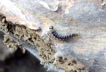
Yponomenta gigas caterpillars and web.

I'd never heard of caterpillars that make cobwebs before, but these do. Like many others caterpilars in the family of ermine moths, they form communal webs. I suppose it discourages birds from sticking their beaks in.

My book on Canarian insects doesn't mention them at all, but then they aren't easy to find unless you know where to look. They live on the Canarian Willow, Salix canariensis which only grows in the Canary Islands and Madeira in places with plenty of water. But there are lots of them in the Caldera de Taburiente, near the campsite at the Playa de Taburiente.

Labels: , , , ,

Bookmark with:

Del.icio.us Digg Reddit Facebook Furl It Newsvine StumbleUpon ToolbarStumbleUpon

Thursday, 3 April 2008

Prehistoric Rock Carvings


The people who lived here before the Spanish invasion in 1493 were called Benauaritas. Since they didn't have writing, not all that much is known about them, and what there is comes from the invaders. Not exactly an unbiased source!

Their technology was pretty basic, maybe because the climate in La Palma is kind enough not to encourage things like weaving. They wore skins, lived mostly in caves, herded goats and grew barley. They also collected things like shellfish and wild dates. There were fourteen tribes on La Palma, and each tribe had its own territory. The modern municipalities roughly correspond to the old kingdoms. Much of their history and culture has been lost.

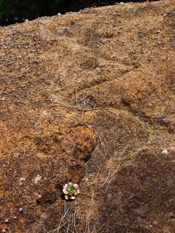
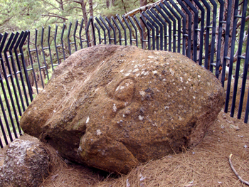
But they did leave behind rock carvings. These are inside the Caldera de Taburiente, but there are far more spectacular ones at La Zarza (in Garafía) and Belamaco (in Mazo). Archaeologists believe that they poured a libation of goats' milk onto the stone, which would flow down the channel, making its shape stand out clearly.

I have a very strange mind. It looks to me as though the stone is imprisoned, presumably because it's dangerous.

Labels: , , , ,

Bookmark with:

Del.icio.us Digg Reddit Facebook Furl It Newsvine StumbleUpon ToolbarStumbleUpon

Monday, 24 March 2008

Napeloen Bonepart in the Caldera de Taburiente

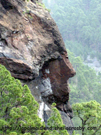
Rock formation in the Caldera de Taburiente, La Palma

A couple of weeks ago, I promised more photos of the Caldera de Taburiente.
At the top of the Caldera there's a rock formation that from one angle looks distinctly like Napoleon Bonepart, or an indian. So it's called Boniface or El Indio. This photo is taken from below the Roque de las Viñas, beside the vineyard.

The best viewpoint has a lethal drop and no guard rail. It's totally unsuitable for small children, people with vertigo, and idiots. I'm assuming readers of this blog have some common sense.

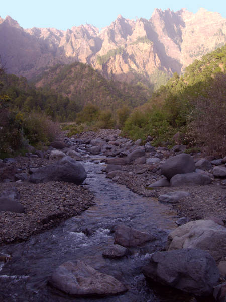
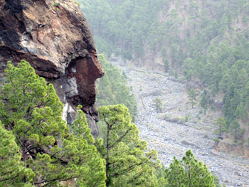
The river bed beneath is the Taburiente. There is water down there, but it's under the stones.

Rock formation in the Caldera de Taburiente, La Palma

Labels: , , ,

Bookmark with:

Del.icio.us Digg Reddit Facebook Furl It Newsvine StumbleUpon ToolbarStumbleUpon

Tuesday, 18 March 2008

The Caldera Campsite

If you're very fit, you can see the Caldera national park on a one-day hike. But it's 27 km of rough going, (from the Los Brecitos viewpoint, via the campsite, to the Barranco de las Angustias) and I wouldn't dare try it myself these days.

The alternative is to spend a night or two at the campsite in the centre of the park, right by the river. This makes it much easier to get into the top end of the park. (Two nights is the maximum stay.) You need a permit in advance, which you get from the Visitor Centre in El Paso (Crta Gral. Padron, 47). They open from 9:00- 14:00 and from16:00- 18:30. You'll need to collect the permit in person, and they'll want to see either a passport or an ID card. Phone 922 497 277

The camp site provides water and picnic tables. There are toilets, but you have to bring your own toilet paper (these little things are important!).

All that water means beautiful, lush greenery, but it also means that mosquitoes can breed almost year-round. Be sure to remember insect repellent.

Pack carefully; it's about 30km to the nearest shop. You have to carry everything in yourself, and you have to take your rubbish away yourself. It's about 7 km from Los Brecitos to the campsite (almost all downhill), and 20km from where the road crosses the river bed in Barranco de las Angustias to the campsite, mostly uphill, and rough in places. In fact one stretch is called "el reventón" which roughly translates as "the killer".

On the other hand, in the middle of summer you don't need a tent. Isn't that nice?

Labels: , , , ,

Bookmark with:

Del.icio.us Digg Reddit Facebook Furl It Newsvine StumbleUpon ToolbarStumbleUpon