A small rock in the Atlantic

All about the island of La Palma, in the Canaries.

Click for La Palma, Canary Islands Forecast

Monday, 14 February 2011

The Caldera de Taburiente

The Caldera de Taburiente from the Roque de los MuchachosThe Caldera de Taburiente from the Roque de los Muchachos


The heart of La Palma is the Caldera de Taburiente.

Caldera is a technical geological term for the crater at the top of a volcano. In fact the term comes from La Palma: all the volcanic calderas in the world were named after ours. So it's really a pity that, since then, the scientists have found out that the Caldera de Taburiete isn't a caldera. It was actually formed by erosion and a gigantic landslide.

However it was formed, the Caldera is spectacular. In most places it's eight kilometres (five miles) across, and many of the rim walls are 1,500 metres high and almost sheer. I haven't seen the Grand Canyon yet, but people who've seen both frequently say that the Caldera looks bigger. You see the Caldera is just on the edge of what your brain can understand, whereas it just gives up when faced with the Grand Canyon.

The Caldera is surprisingly hard to photograph well, because you loose the sense of scale. This photo was taken from the observatory late one morning, and the scale mostly comes from the aerial perspective - the way distant objects are bluer. On this day there was just the right amount of dust in the air to give a sense of scale without hiding more distant details. I like the way the sunlight catches the cloud waterfall.

It's even more beautiful from inside, although that does mean a long hike. You can stay at the Caldera campsite for a couple of nights to give you more time to explore.
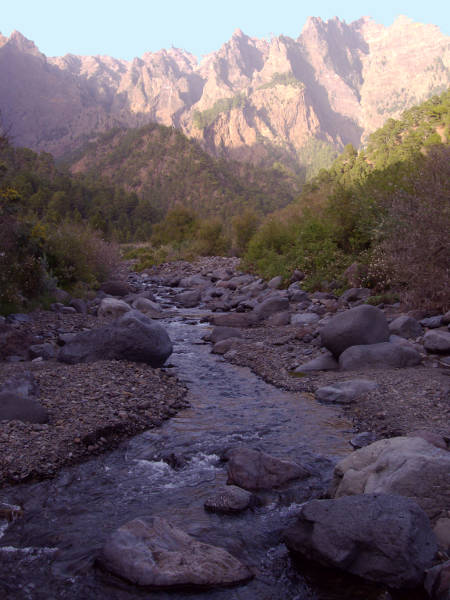

The Taburiente, near the Caldera camp site

Labels: , , , ,

Bookmark with:

Del.icio.us Digg Reddit Facebook Furl It Newsvine StumbleUpon ToolbarStumbleUpon

Sunday, 14 November 2010

Footpaths on La Palma

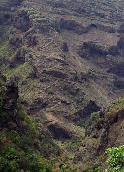
Long distance footpath in GarafiaA steep section of long distance footpath in Garafia

La Palma has a network of well-marked footpaths, most of which are centuries old. As late as the 1960s, walking was still a major form of transport for the islanders,

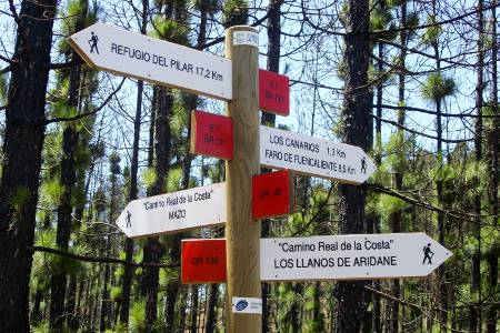
The whole network of hiking trails on the island comes to over 1,000 km, and between them they pass through just about every kind of scenery on the island: lava fields, pine forests, lush laurel forests, farmland and village centres. Some are very short, but this small islands has two long distance paths. The GR 131 runs in a giant question mark from Puerto Tazacorte, up around the Caldera rim, past the Roque, and down the central ridge of the island to the southern tip. Super-fit athletes can run it in a day as an ultramrathon, but normal walkers take at least three days. The GR130 runs right around the island, between sea-level and 1,000 m, which includes a wonderful variety of landscapes. Someone well used to hiking takes about a week. I'm doing it in much smaller installments, but I'm loving it.
Where the two main footpaths meet in FuencalienteWhere the two main footpaths meet in Fuencaliente

Labels: ,

Bookmark with:

Del.icio.us Digg Reddit Facebook Furl It Newsvine StumbleUpon ToolbarStumbleUpon

Friday, 2 October 2009

The Outdoor & Walking Festival

Cubo de la Galga, Puntallana, La Palma
Cubo de la Galga, Puntallana

La Palma has a wonderful network of hiking trails, providing a great variety of landscapes and levels of difficulty. And this weekend, the island's hosting an outdoor and walking festival. You can go on a guided walk for free, but you have to register in advance: see http://www.senderosdelapalma.com/walkingfestival/actividades.php although places are filling up fast. I'm probably going to miss it because you have to meet the bus at Los Llanos to get to and from the walk. This is great for walks where you don't come back to your starting point, obviously, but I get very travel sick in buses.

All the buses leave from the Plaza España in Los Llanos, and they have a programme of other events there, too from Friday evening to Saturday evening.
Friday
o 17:00 horas.- Inauguration of the Plaza del Senderista.
o 17:00 - 21:00 horas.- Exhibition of local food .
o 17:30 - 19:00 horas.- Workshop focused on: Salto del Pastor, is a means of moving with a spear, which is used to jump over uneaven ground and geographical features.
o 18:00 - 20:00 horas.- Local food tasting.
o 18:00 - 19:00 horas.- Exhibition of stilts in Plaza del Senderista by TEATRO KDO.
o 19:00 - 21:00 horas.- Seminar "Periodismo de Montaña", focused on journalism in mountains.
o 22:00 horas.- Launch of the song "SENDEROS DE LA PALMA". A concert by Moise González & Son Iyá (salsa). Special guest stars: José Manuel Ramos, León de Romeo, Beselch Rodriguez.

Saturday

o 10:00 - 12:00 horas.- Different activities and games for children.
o 12:00 - 13:00 horas.- Clowns and big balls at Plaza del Senderista with TEATRO KDO..
o 13:00 - 14:00 horas.- Humor with MANOLO VIEIRA.
o 17:00 horas.- Inauguration of the Plaza del Senderista.
o 10:00 - 21:00 horas.- Exhibition of local food.
o 17:00 - 18:00 horas.- Launch of sport (hiking and climbing) equipment. At the main stage.
o 18:00 - 20:00 horas.- Local food tasting
o 18.00 - 20:00 horas.- Globoflexia at Plaza del Senderista by Teatro Kdo
o 18:00 - 20:00 horas.- Workshop on GPS and Geocoahing, Geocoaching games at Plaza del Senderista.

Volcán de San Antonio (Fuencaliente):

o 22:00 horas.- Closing ceremony "Luces y Música en el Volcán". At the San Antonio volcano. (Volcán de San Antonio (Fuencaliente)


The summit of Teneguía, Fuencaliente, La Palma
The summit of Teneguía, Fuencaliente

Labels: ,

Bookmark with:

Del.icio.us Digg Reddit Facebook Furl It Newsvine StumbleUpon ToolbarStumbleUpon

Saturday, 26 April 2008

Cubo de la Galga


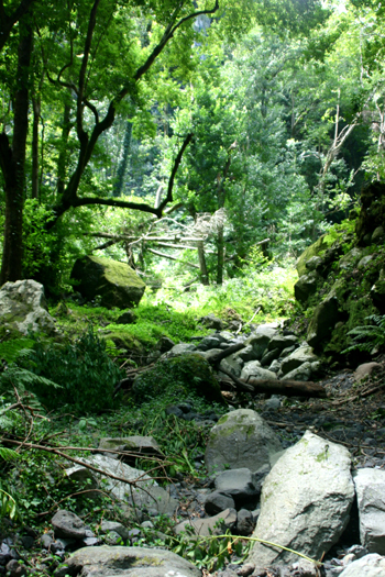
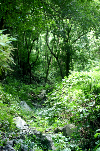
Cubo de la Galga is a very pretty walk along the bottom of the Galga ravine, between Puntallana and Los Sauces. By Palmeran standards, it's an easy walk.


"Walk! La Palma" is a good book, but the bit about the bottom end of the walk at Cubo de la Galga is out of date already. The Island Government (the Cabildo) have been busy.


There is now a car park at the beginning of the walk, on the road at km 16. You're unlikely to get lost for the first kilometre or so, because the path's actually asphalted, never mind signposted. It's a matter of taste, but this part was a bit too tamed for my taste, and I was glad when the asphalt stopped. In fact the path is currently so smooth you could actually walk for a couple of kilometers in stilettos, if stilettos are your thing. (I bought a pair of stilettos just before I came to La Palma. I've used them so little that seventeen years later, they still don't even need heeling.)


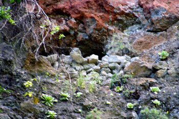
There are caves in the ravine walls. This one has a wall built across the mouth. at the time we wondered whether people had lived there at one time. Now I wonder whether it mightn't be the "windows" in the water channel, the Canal de Estado.


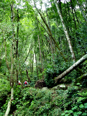
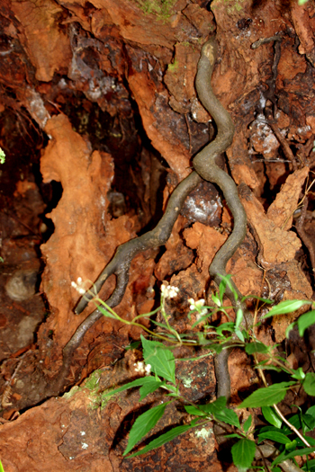
The book is absolutely right that the place would be famous if it weren't so close to Los Tilos. The path criss-crosses the stream bed (a trickle in April) and the ravine walls and trees tower over you.


This means that the roots are at eye-level.


When the signpost seemed to indicate that it was time to turn back, we carried on a little, up a much rougher path.


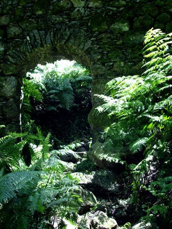
The path went under a little aqueduct.


Just above there is a flattish space, where we stopped to eat our sandwiches. Above that, the path divides. According to Charles Davis, you can make your way back to the road by another route, but we weren't sure of the way and I had to get back for the babysitter. So I can't tell you whether there are still fallen trees over the track.


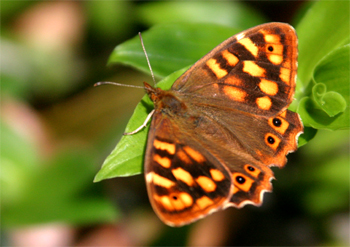
Throughout the walk, there were lots of butterflies, mostly sitting still until the camera focused, and then fluttering off. But I got lucky eventually. This one is common in the western Canaries, but lives nowhere else.

Maculada de Canarias butterfly, Pararge xiphioides

Labels: , , , , , , ,

Bookmark with:

Del.icio.us Digg Reddit Facebook Furl It Newsvine StumbleUpon ToolbarStumbleUpon